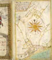
A collaboration between Wiltshire and Swindon History Centre (WSHC) and the New Folkestone Society (NFS) has resulted in the conservation of this wonderful book 17th-century of maps of the Folkestone estates of Jacob Desbouvery.
The map book is among the WSHC's holdings, in the collection of the Earls of Radnor. Abraham Walter’s Book of Maps dated 1699 is a significant historical document for Folkestone, being part of the family collection of the Earls of Radnor held in the Wiltshire and Swindon Archives (Ref 1946/2/3E/1). The maps have indexes indicating ownership, land use and acreage. Accompanying the volume are four loose pages of handwritten analysis of the indexes.
Abraham Walter was a cartographer living in Kent and known for his colourful and elaborately illustrated maps. In this volume they are highlighted in parts with gilding, illustrations of animals, fish and the occasional passing ship and rowing boat in the Channel.
The project objective was to conserve and stabilise the text block and covers which had separated and were in a dilapidated and fragile condition. With the grant from NMCT this has been achieved and they are now re-housed in bespoke archival boxes in the Wiltshire Swindon History Centre. The images of the maps have been digitised and are available on the transferred to the NFS website, the invaluable information contained in them being made available for universal, educational and historical study.
Amongst many interesting discoveries was the use of glitter/glass in the painted areas of the illustrations, mostly to give a sparkly appearance to the sea. Also, it appears that the parchment text block was constructed and bound before being used – this would explain the number of blank pages of parchment at the back of the volume and the double page illustrations/maps painted across sections.
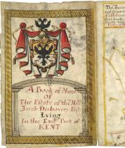
Frontispiece.